From the forums:
1) I need to plot pollutant concentration contours on an aerial image.
I have been evaluating dPlot and it can accept data from my dispersion modeling program. So dPlot does most of what I want except for the final step of applying a 'base map' so that the contours appear overlaid on a background aerial image.
Photoshop can combine two jpgs, but I would prefer it if there was a way to do it within dPlot so I don't need Photoshop.
and...
2) I am evaluating the capability of DPlot for my application. Overall, this is the great software with this price. I am going to buy it anyway. My application requires the background image(s) -- layer(s) of PCBA drawings, and foreground with a 3D Contour (rainbow colored) graphic shows the NFE (Near Field Emission) level. The foreground should be able to Alpha-blend with background image.
This can be done with another application (like Visio), but needs additional steps. It will be a great feature if this can be done in DPlot application.
Starting with version 2.2.8.8, either can be done. You can specify an image that will be drawn either in the foreground or background, with a specified transparency level and optionally a background color that will not be drawn. In addition, the alpha channel in 32-bit PNG files and the transparent color (if any) in 8-bit GIF or PNG images is respected.
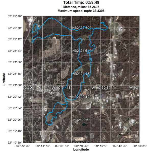
1) The first example is a latitude-longitude recording of a Garmin GPS device overlaid on a Google Earth image:

2) The following image is a surface plot with an overlaid JPG schematic drawn with a transparency value of 50 (0=invisible, 255=opaque):

For more information see the Background Image topic in the online manual or the corresponding entry in the Help file.

